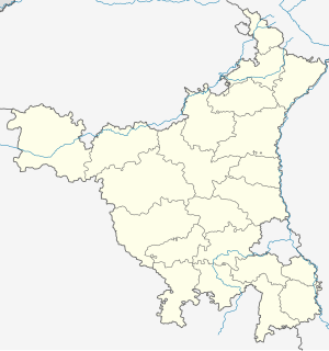
Jamalpur, Bhiwani
Appearance
Jamalpur | |
|---|---|
Village | |
| Coordinates: 28°57′43″N 75°57′25″E / 28.96194°N 75.95694°E | |
| Country | |
| Founded by | Named a person Jamaal |
| Named for | Jamalpur |
| Government | |
| • Type | Bharatiya Janata Party |
| • Body | Panchayat |
| • Sarpanch | RAJKUMAR LIC |
| Area | |
• Total | 541 km2 (209 sq mi) |
| • Rank | 1 Rank |
| Elevation | 215 m (705 ft) |
| Population (2011) | |
• Total | 8,846 |
| • Density | 16/km2 (42/sq mi) |
| Languages | |
| • Official | Hindi |
| Time zone | UTC+5:30 (IST) |
| PIN | 127035[1] |
| Vehicle registration | HR 16 |
| Website | haryana |
Jamalpur is a village in the Bawani Khera tehsil and Bawani Khera (Vidhan Sabha constituency) of Bhiwani district in Haryana state of India. It lies approximately 8 kilometres (5.0 mi) north west of Bawani Khera and 25 kilometres (16 mi) south east of the district headquarters town of Bhiwani.
Demographic
[edit]As of the 2011 Census of India[update], the village had 1723 households with a population of 8,846 of which 4,668 were male and 4,178 female.[2]
Economy
[edit]Economy is mainly agrarian, supported by small number of government job and minor local commercial activities such as Ishan Automobiles, an authorized service centre of Bajaj Two-wheeler.
See also
[edit]External links
[edit]References
[edit]- ^ Pin codes of Jamalpur, mapsofindia.com
- ^ "Jamalpur village". Census of India. Retrieved 19 July 2015.


